THE ASAHI SHIMBUN
August 27, 2024 at 17:08 JST
 The expected path of Typhoon No. 10 as of 8 a.m. on Aug. 27 (Captured from the Japan Meteorological Agency's website)
Typhoon No. 10 continues to grow in intensity and is expected to approach the Amami region by Aug. 28, according to the Japan Meteorological Agency.
The JMA also issued heavy rainfall warnings to Pacific Ocean-side areas in western and eastern Japan on Aug. 27.
The expected rainfall total over 24 hours—measured until noon on Aug. 28—is 400 millimeters in Amami, 300 mm in southern Kyushu and 200 mm in the Tokai region.
Central Japan Railway Co. (JR Tokai) suspended its operation of the Tokaido Shinkansen Line in some sections after 8 a.m. on Aug. 27 before resuming it at 9:15 a.m. on the same day because of the downpour.
West Japan Railway Co. (JR West) also suspended the Sanyo Shinkansen Line between Shin-Osaka and Okayama due to torrential rain in the morning of Aug. 27 and warned that it will halt operations again between Aug. 29 and 31.
Meanwhile, East Japan Railway Co. (JR East) plans to run the Joetsu, Hokuriku and Tohoku Shinkansen lines as usual.
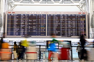
As for the skies, Japan Airlines announced it has canceled a total of 116 flights arriving at or departing from the Kyushu region, Tokyo's Haneda and Osaka's Itami airports on Aug. 27 and 28. The planned cancellations are as of 11 a.m. on Aug. 27.
All Nippon Airways announced possible disruptions in flights arriving at or departing from the Kyushu, Kansai, Chugoku and Shikoku regions between Aug. 28 and 30.
As of 10 a.m. on Aug. 27, Typhoon No. 10 was about 110 kilometers east of Amami and is building strength as it slowly travels west-northwest.
Winds near its center hit a top speed of 162 kph with a central atmospheric pressure of 950 hectopascals while its maximum instantaneous wind speed reached 216 kph.
The latest forecast map is available on the JMA website.
(This article was written by Takuya Miyano and Akihiro Nishiyama.)


A peek through the music industry’s curtain at the producers who harnessed social media to help their idols go global.
A series based on diplomatic documents declassified by Japan’s Foreign Ministry
Here is a collection of first-hand accounts by “hibakusha” atomic bomb survivors.
Cooking experts, chefs and others involved in the field of food introduce their special recipes intertwined with their paths in life.
A series about Japanese-Americans and their memories of World War II