THE ASAHI SHIMBUN
August 17, 2024 at 12:04 JST
Powerful Typhoon No. 7 is now moving away from the Japanese archipelago after pounding the Kanto-Koshin and Tohoku regions with heavy rain and high winds from the night of Aug. 16 through dawn of Aug. 17.
The Japan Meteorological Agency continued to warn of landslides and other disaster situations, especially in the Tohoku region, and urged people in the Kanto region to be careful of the stifling heat after the typhoon passed.
As of 6:45 a.m. on Aug. 17, the typhoon was moving east-northeast at a speed of about 20 kph, about 230 kilometers east of Choshi in Chiba Prefecture, the agency said. Heavy rain with thunder is expected to continue in some areas in the northeastern part of the country until the evening of Aug. 17.
Meantime, the Kanto area is expected to be covered by a high pressure system and clear skies, and temperatures are expected to rise due to the warm air flowing toward Typhoon No. 7.
The JMA and the Environment Ministry issued heat stroke alerts for Tokyo as well as for neighboring Saitama, Kanagawa, Chiba, and Ibaraki prefectures. The mercury was forecast to reach 39 degrees in Kumagaya, Saitama Prefecture, and 36 degrees in Tokyo and Yokohama.
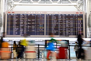
Tokaido Shinkansen bullet trains, which were suspended between Tokyo and Nagoya stations throughout Aug. 16 due to the approach of the typhoon, resumed normal operations from the first departure on Aug. 17.
The earlier suspension of service meant that many Nozomi trains were full on Aug. 17, especially in the morning. To increase transportation capacity, Central Japan Railway Co. (JR Tokai) added seven extra Nozomi trains between 6 a.m. and 11 a.m. on both the inbound and outbound routes.


A peek through the music industry’s curtain at the producers who harnessed social media to help their idols go global.
A series based on diplomatic documents declassified by Japan’s Foreign Ministry
Here is a collection of first-hand accounts by “hibakusha” atomic bomb survivors.
Cooking experts, chefs and others involved in the field of food introduce their special recipes intertwined with their paths in life.
A series about Japanese-Americans and their memories of World War II