THE ASAHI SHIMBUN
December 3, 2024 at 17:27 JST
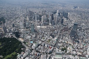
 People wear short-sleeved shirts in late November around the Imperial Palace in Tokyo’s Chiyoda Ward on Nov. 27. (Hikaru Uchida)
The average temperature from September through November was 1.97 degrees higher than normal, marking the warmest autumn in Japan since record keeping began in 1898, the Japan Meteorological Agency said Dec. 2.
Last year’s average fall temperature was 1.39 degrees higher than normal.
Although temperatures have fluctuated, the average temperature of autumn in Japan has risen by 1.43 degrees over the past 100 years.
According to the JMA, westerly winds blew more northerly than usual this fall, causing warm air to cover the entire country and leading to several days with temperatures significantly higher than the average.
Meanwhile, the La Nina phenomenon, in which sea surface temperatures drop around the coast of Peru near the equator, has become notable in recent years and also occurred this year. This caused lower than average temperatures in Japan on several days in late November.
The JMA forecast “typical winter” weather in Japan from December through February, with the possibility of heavy snowfalls on the Sea of Japan side.
The westerly winds are expected to flow slightly farther south than usual over Japan, bringing strong cold air from the north.
“Many people may feel temperature differences that are greater than usual. Please be prepared for snow,” a JMA official warned.
WEIRD NOVEMBER WEATHER
A series of unprecedented weather phenomena occurred in November, caused largely by “meandering trade winds” and “high sea surface temperatures.”
In early November, trade winds blowing from east to west near the equator meandered like waves in a north-south direction, which created a counterclockwise wind pattern and typhoon “eggs” over the sea south of Japan.
This led to the unprecedented occurrence of four simultaneous typhoons in November.
Some researchers believe that 10 percent to 20 percent of typhoons are caused by meandering trade winds.
“In November, the number of typhoons usually decreases,” said Ryuichi Kawamura, a professor of meteorology at Kyushu University. “It is extremely rare that four typhoons would form out of trade winds at the same time.”
Another factor is the high temperature of sea surface water.
According to the JMA, the average sea surface temperature off Japan in November was 1.7 degrees higher than in average years and set a record for the month.
Last year’s average November temperature was 0.9 degree above average.
When sea surface temperatures are high, the amount of water vapor in the atmosphere increases, making heavy rainfalls more likely.
“There is no doubt that the recent warming of the oceans is contributing to the increase in precipitation,” Kawamura said.
Before dawn on Nov. 9, a heavy rain special warning was issued for Yoron in Kagoshima Prefecture. It was the first such warning in November since its inception in 2013.
Hideyuki Motozono, a 51-year-old local tour guide, said he prepared life jackets for his family of five by the front door before he went to bed that night.
“It was a type of rain I had never experienced before,” he recalled.
On Nov. 7, the top of Mount Fuji was covered in snow--the latest snowcap in 130 years of observations.
In Shizuoka Prefecture, five locations recorded the latest “summer day” with temperatures above 25 degrees on Nov. 17.
(This article was written by Shoko Rikimaru and Fumi Yada.)


A peek through the music industry’s curtain at the producers who harnessed social media to help their idols go global.
A series based on diplomatic documents declassified by Japan’s Foreign Ministry
Here is a collection of first-hand accounts by “hibakusha” atomic bomb survivors.
Cooking experts, chefs and others involved in the field of food introduce their special recipes intertwined with their paths in life.
A series about Japanese-Americans and their memories of World War II